
Transportation is one of the largest barriers to accessible travel and savvy disabled travelers consider all modes of accessible transportation when plotting their routes. Intercity bus services are a key part of my own accessible travel strategy, particularly in the United States where bus services are required to be accessible with wheelchair lifts and at least two wheelchair securement spaces.
Intercity bus services like Greyhound have carried me thousands of miles over the years, but searching available bus routes is tricky — there is no central clearinghouse for bus routes and schedules like there is for flights. This month, the U.S. Department of Transportation's Bureau of Transportation Statistics took a big step towards making that a reality with the new Intercity Bus Atlas, a free, web-based interactive map of the intercity bus network in the United States.
How the Atlas Works
According to the BTS announcement, the atlas reflects data that was voluntarily provided by about 60 scheduled intercity bus operators. The nationwide map displays some 1,800 routes and approximately 3,500 individual bus stops. BTS accurately describes the atlas as the only regularly updated map of the country's scheduled intercity bus network.
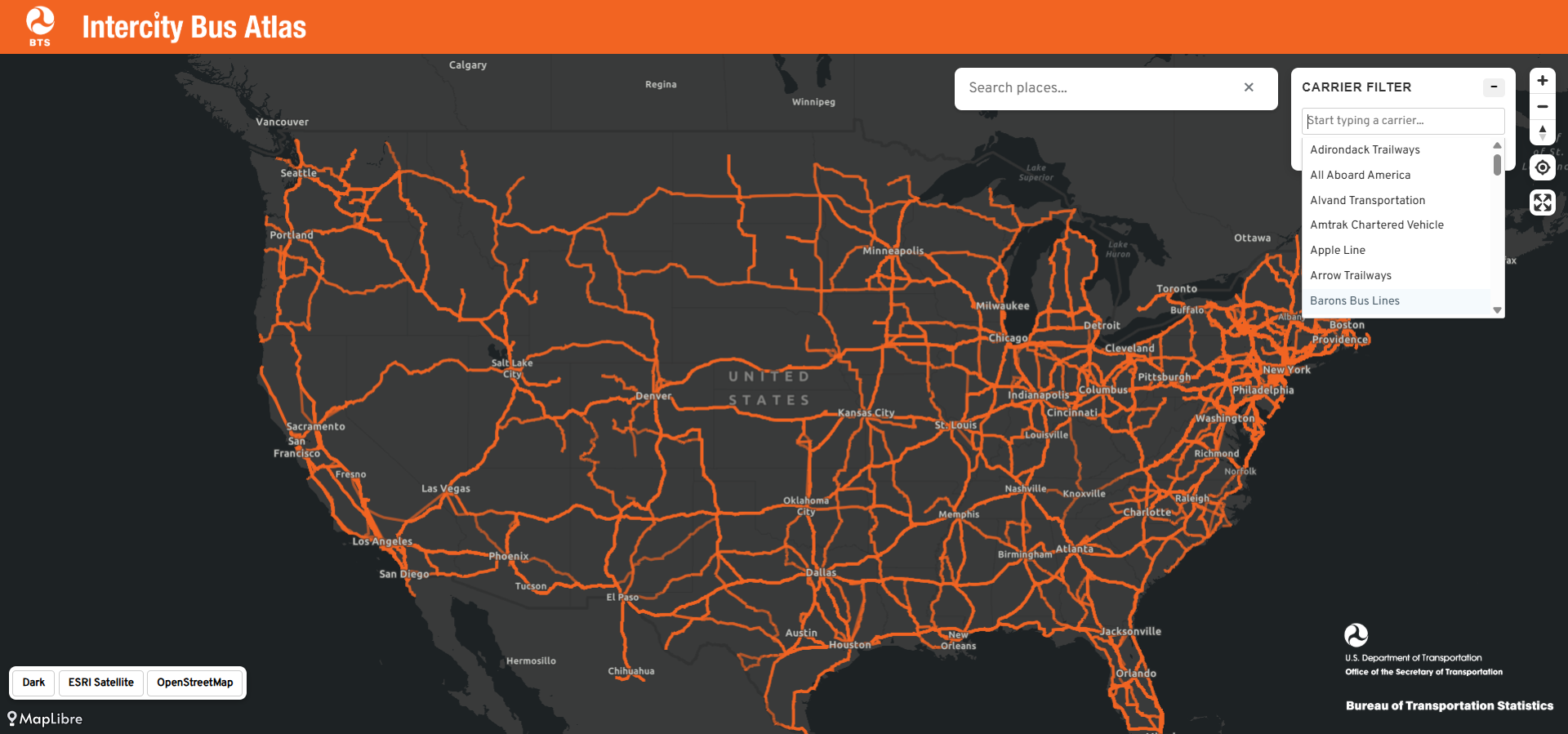
The atlas is simple to use. Enter a city name in the search box, and the map displays the intercity bus routes connected to it including services originating in that city, arriving to it or passing through. You can also filter the map by carrier to highlight a single operator's network.
Why the Intercity Bus Atlas Matters
The value in this map is in the ability to discover different ways to travel between cities. Used in conjunction with other resources, the atlas helps travelers consider all of their travel options — in much the same way that the Google Flights map permits air travelers to see every destination reachable from their home airport. Type in a mid-size city and you may be surprised by the number of bus routes radiating outward, many of them serving communities that have no airport and, increasingly, no Amtrak station. For the millions of Americans who live in places that airlines and rail operators have abandoned, the intercity bus is a transportation lifeline.

Wheelchair users also benefit tremendously. Modern motorcoaches operated by the major carriers are equipped with wheelchair lifts and securement areas, and the Americans with Disabilities Act requires large fixed-route operators to provide accessible service. Bus travel is often the most affordable intercity option and it delivers passengers to city centers rather than distant airports, and — critically for many power wheelchair users — it never requires you to surrender your wheelchair to a cargo hold.
Future Improvements to the Bus Atlas
The BTS admins that the Intercity Bus Atlas is incomplete and a work in progress. Because the underlying data is supplied voluntarily by carriers, many operators and routes are still not included. One omission I noticed is Megabus, a major player in the intercity market whose wheelchair accessible service I have reviewed previously. When data from one of the nation's largest bus operators is not included, travelers may overlook real transportation options. That should incentivize operators to supply their route data.
I would also challenge BTS to go one step further: incorporate accessibility information into the atlas. A layer identifying wheelchair accessible stops and accessibility features would transform this from a useful map into an indispensable resource for disabled travelers.
 John Morris
The Bottom Line
The Intercity Bus Atlas is a great start, and I am glad to see the federal government shining a light on a mode of transportation that many travelers overlook. Travelers like you should explore the atlas at maps.dot.gov/BTS/IntercityBusAtlas and consider taking the bus for your next trip — it can be an inexpensive, convenient and accessible way to travel across the United States.